Tag: rock

Away From The Road – Day 2 of 5: Smith Rocks
Smith Rock State Park is located near Hwy-97 a few minutes north of Redmond, near Terrebonne just north of milepost 116. Smith Rock State Park is considered the birthplace of modern sport climbing. The park contains the first U.S. climb… read more Away From The Road – Day 2 of 5: Smith Rocks

Away From The Road – Day 1 of 5: Toketee Falls
Toketee Falls is located east of Roseburg, Oregon. The 120 foot/37 meter two stage plunge through a cut in the columnar basalt wall is one of my favorites. Toketee Falls is located on the North Umpqua River where is meets Clearwater… read more Away From The Road – Day 1 of 5: Toketee Falls

Fogarty Creek Sunset
Fogarty Creek State Park is located on the coast between Depoe Bay and Lincoln City, south of milepost 124. A sandy beach is at the north end of the park, while a rocky area becomes visible at low tide on… read more Fogarty Creek Sunset

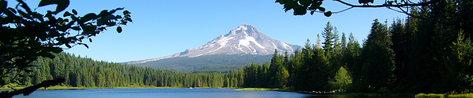
Belknap and McKenzie Pass
You can see Belknap Crater area and part of the 65 sq mi/170 km2 basaltic andesite lava flow at McKenzie Pass in this photograph. Belknap is the youngest shield volcano in the Cascade range with an elevation of 6,876 ft/2,096… read more Belknap and McKenzie Pass

Obsidian Volcanic Glass
Obsidian is a volcanic glass formed when felsic lava cools rapidly, minimizing crystal growth. Historically it has been used for weapons, tools and even a surgical edge. When processed correctly, obsidian will provide a long lasting very sharp edge. You… read more Obsidian Volcanic Glass

Qochax Island and Sunset Beach
A low tide, Qochax Island looks like a rock monster emerging from the ocean from this viewpoint at Sunset Beach. Sunset Beach is at Sunset Bay State Park, which is adjacent to Shore Acres State Park, SE of North Bend/Coos… read more Qochax Island and Sunset Beach

Multnomah Falls
The 620 foot / 189 meter falls are visible from Interstate Hwy-84. A parking area for the falls actually lies between the east and west bound lanes of the freeway. The falls are actually two falls, 542 ft/165m upper fall… read more Multnomah Falls

Balancing Rocks
This place used to be amazing. A forest fire burned down the pine tree forest, and then partying students ruined it. Erosion over thousands of years left these boulders balancing on volcanic tuff columns. The area was known, but to… read more Balancing Rocks

Lined Shore Crab
This little crab was spotted at the Yaquina Head Outstanding Natural Area just north of Newport on the central Oregon coast. Mature these crabs measure about 2 in/5cm across. Download SD Wallpaper Location via Google Maps

Steins Pillar
Steins Pillar stands 350 feet tall, towering above the meadows and ponderosa and lodgepole pine trees below. Named after Major Enoch Steen, a misspelling took hold and we have Steins Pillar. It is a remnant of valley full of ash… read more Steins Pillar

Upper North Falls
Located at Silver Falls State Park, this 65 ft/20 m curtain style waterfall is at the end of a very easy mostly flat walk. When the trail ends, this is the view. This is the eastern most waterfall in the “Trail of… read more Upper North Falls

Heceta Head Lighthouse
Perhaps this is not nature, but the surrounding area is. Built in 1893, this 56ft/17 m tower sits 205 ft/65 m above sea level. Its light, which is now an automated beacon, is the most powerful on the Oregon Coast… read more Heceta Head Lighthouse